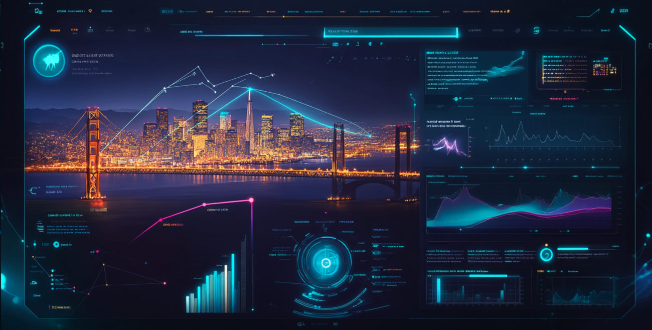
Hey everyone! TM here, founder of EarthScene. Today I want to share something I’m really excited about — our decision to make microclimates a central feature of the EarthScene platform. This wasn’t just a random design choice; it came from months of research and thinking about how people actually experience weather in their daily lives.
Most weather apps show you a single temperature for your entire city or zip code. But anyone who’s lived in a hilly area, near water, or even in a city with tall buildings knows that’s not how weather really works. The temperature, wind, and even precipitation can vary dramatically within just a few blocks or miles!
The Problem with Single-Point Weather Data
When I started researching weather apps, I noticed something that didn’t make sense. Most major cities have just one or two official weather stations, usually at airports. But airports are often in open areas away from downtown, residential neighborhoods, or parks — the places where people actually spend their time.
This means when your typical weather app tells you “It’s 75°F in San Francisco,” that reading might be coming from SFO airport, which can be 10-15°F warmer than the foggy neighborhoods near the Golden Gate! Or it might say “No rain in Seattle” while half the city is getting soaked because the official station isn’t catching a localized shower.
I realized this was a huge problem that needed solving. Most people don’t experience the “average” temperature of their city — they experience the specific microclimate of their neighborhood, campus, or workplace.
What Makes Microclimates So Important?
A microclimate is a local atmospheric zone where the climate differs from the surrounding area. These can form for lots of reasons:
- Elevation changes (hills, valleys)
- Proximity to water bodies (lakes, oceans, rivers)
- Urban heat islands (cities vs. suburbs)
- Vegetation differences (forests vs. open areas)
- Building density and height (downtown vs. residential areas)
In my research, I found some cities can have temperature variations of up to 20°F between different neighborhoods at the same time! That’s not just a minor detail — it’s the difference between wearing a t-shirt or needing a jacket.
How EarthScene’s Microclimate Approach Works
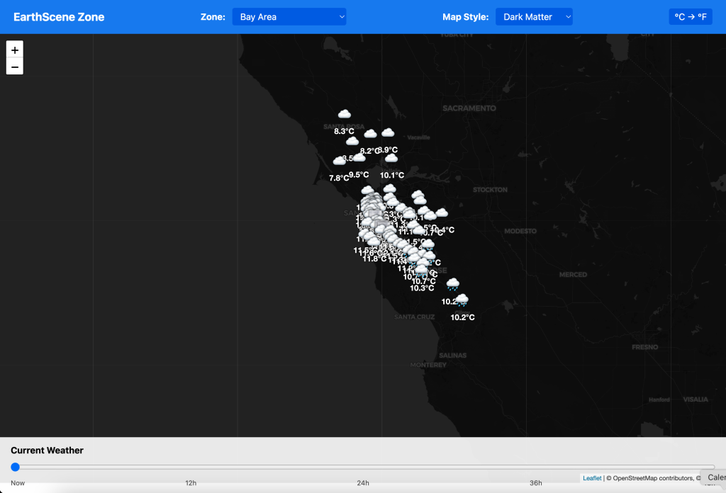
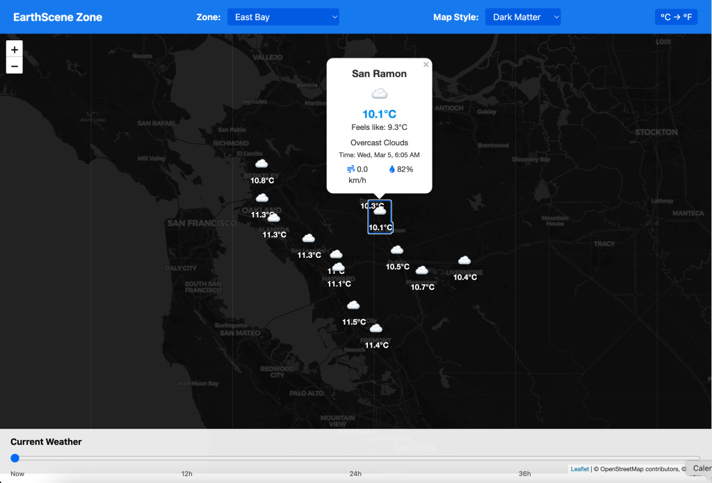
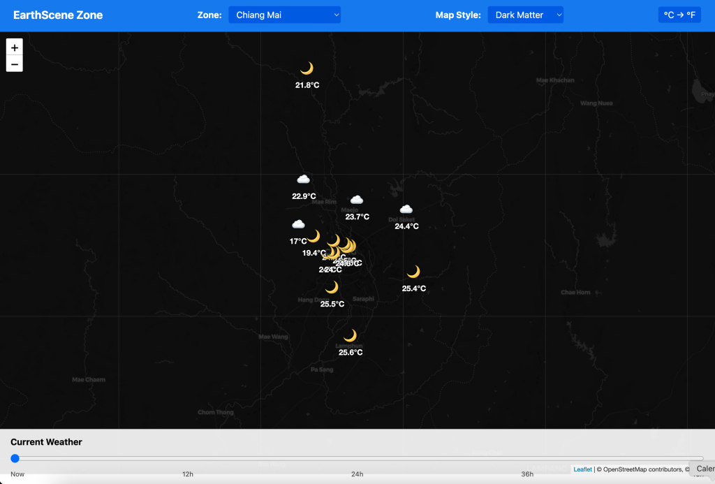
Instead of showing a single temperature for your location, EarthScene displays a visual microclimate map that shows variations across your area. Users can:
- View their entire region with color-coded temperature, precipitation, and wind patterns
- Automatically detect their precise location for hyperlocal readings
- Save multiple locations (home, work, school, etc.) to track different microclimates
- See how conditions change along routes for commuting or outdoor activities
We combine data from multiple sources: official weather stations, IoT devices, satellite data, and physical geography models. Then our algorithm interpolates between these points to create a detailed microclimate map that’s accurate down to about 500 meters in urban areas.
Key Benefits of EarthScene’s Microclimate Approach
1. Spatial Awareness and Context
When you open EarthScene, you immediately see how conditions vary across your area. This gives you context that a single temperature reading can’t provide. Is it warmer downtown? Windier near the shore? Raining in the hills but dry in the valley? Our visualization makes these patterns instantly clear.
This spatial awareness is especially valuable in areas with complex geography. During my testing in the San Francisco Bay Area, users were amazed to see the clear visualization of the famous microclimates that locals always talk about but rarely see mapped out.
2. Smarter Decision Making
With microclimate data, you can make better informed decisions about your day. If you’re planning a bike ride, you can see which route has the most favorable conditions. If you’re choosing between two parks for a picnic, you can instantly compare them. If you’re wondering whether to bring a jacket downtown even though it’s warm at home, EarthScene gives you that insight.
During beta testing, users reported that they changed their plans based on microclimate data at least once a week, leading to better experiences and fewer weather-related surprises.
3. Educational Value and Environmental Awareness
One unexpected benefit we discovered is how EarthScene helps users understand local climate patterns. By observing how temperature and weather conditions flow across terrain over time, users develop a much deeper understanding of their local environment.
This has educational value, but it also connects people more deeply to their environment. Our beta testers reported becoming more aware of how geographic features influence their daily weather, which many found fascinating.
4. Truly Personalized Weather
With microclimate data, personalization becomes much more meaningful. EarthScene doesn’t just show you “the weather” — it shows you your weather, specific to where you actually are. Our location precision is accurate enough to know if you’re in a shadier part of campus or on the sunny side of your neighborhood.
This hyper-local approach also improves our alerts and forecasts. Instead of generic “rain possible in your area” alerts, we can tell you “heavy rain expected in your specific neighborhood starting at 3:15 PM.”
5. Advanced Data Visualization
Weather is complex, multidimensional data. By visualizing it spatially using color gradients, animated patterns, and interactive elements, we can communicate much more information than simple icons and numbers.
Our visualization approach makes it easy to see patterns and relationships that would be invisible in traditional weather apps. For example, you can watch how temperature changes as marine air moves inland, or see how a rain shower develops and moves across your area.
The Tech Behind Our Approach
Building a microclimate system is technically challenging, which is why most weather apps don’t attempt it. Here’s a simplified look at how we make it work:
- Multiple data sources: We combine official weather station data, private weather station networks, satellite observations, radar, and geographic information
- Terrain and land use modeling: We incorporate elevation, vegetation, urban development, and water bodies into our models
- Machine learning: Our algorithms continually improve by learning from observed patterns and comparing predictions to actual measurements
- Efficient rendering: We’ve developed custom rendering techniques to display microclimate data smoothly on mobile devices without draining battery
While this is technically complex, the user experience remains simple and intuitive. All the complexity happens behind the scenes.
Why Other Apps Don’t Do This (Yet)
You might wonder why larger weather providers don’t offer this level of microclimate detail. There are a few reasons:
- It requires significantly more computational resources
- Traditional meteorological approaches focus on larger weather systems
- Many companies are tied to legacy systems and data sources
- The visualization challenges are substantial
As a new platform built from the ground up, EarthScene doesn’t have these limitations. We’ve designed our entire system around microclimates from day one, making it core to our approach rather than an add-on feature.
The Future of Microclimate Data
I believe microclimate awareness is the future of weather technology. As our climate changes and weather becomes more variable, understanding these local patterns becomes even more important.
For EarthScene, this is just the beginning. We’re working on:
- Crowdsourced temperature and condition reporting to further improve accuracy
- Integration with smart home systems to optimize energy use based on microclimate patterns
- Predictive microclimate modeling that improves forecast accuracy at the local level
- Developer APIs so other applications can benefit from our microclimate data
Try It For Yourself
EarthScene is currently in beta, and we’re looking for users who are interested in experiencing weather in a whole new way. If you’d like to be among the first to try our microclimate approach, sign up for our beta program below.
I’d love to hear your thoughts on our microclimate approach. Does this seem useful for your area? Are there specific microclimate features you’d like to see? Drop a comment below!
– TM, Founder of EarthScene
Posted on March 4, 2025