What’s up, everyone! TM here again with more mapping platform research for our EarthScene project. After diving into Google Maps and Apple Maps, I wanted to check out some alternative platforms that might actually be more relevant for what we’re building. Today I’m exploring OpenStreetMap, Mapbox, MapLibre, and Leaflet – the platforms powering tons of cool apps and websites you probably use without even realizing it!
OpenStreetMap (OSM): The Wikipedia of Maps
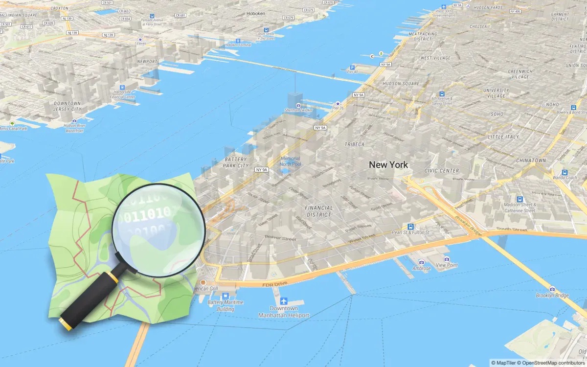
OpenStreetMap is seriously one of the coolest projects on the internet. It’s basically like Wikipedia but for maps – created by volunteers from around the world who add and edit data. It started in 2004 when this British guy named Steve Coast got frustrated that map data in the UK was super expensive and restricted.
How OSM Works
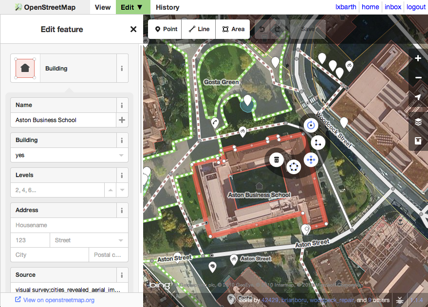
What makes OSM different from commercial maps is that ANYONE can contribute. I’ve actually edited it myself to add a new trail near my house! Here’s how the data flows:
- Contributors (over 8 million registered users) add roads, buildings, parks, etc.
- Data gets stored in a massive database using a simple data model of nodes, ways, and relations
- The community reviews and improves the data
- Everything is free to use under the Open Database License (ODbL)
Where OSM Gets Its Data
Unlike Google or Apple, OSM doesn’t have billion-dollar budgets for data collection. Instead, it uses:
- Volunteer contributions: People map their local areas using the OSM editor
- GPS traces: Contributors upload GPS tracks from their phones or dedicated devices
- Aerial imagery: Volunteers trace features from satellite/aerial images (donated by companies like Bing and Mapbox)
- Government data: Some governments release their geographic data to the public
- Import projects: Carefully managed imports of open data (like the TIGER data from the US Census)
- Corporate donations: Companies like Facebook and Microsoft contribute data they’ve collected
OSM’s Business Model (or Lack Thereof)
Here’s the thing – OSM itself doesn’t really have a business model! It’s a non-profit foundation supported by donations and corporate sponsorships. Their annual budget is tiny compared to what Google spends – just about $1 million per year. But their impact is MASSIVE because:
- The data is free for anyone to use (with attribution)
- No API limits or high costs that block small developers
- No tracking or privacy concerns
- Full control over how the maps look and function
This is why OSM data powers so many other mapping services – including some of the ones I’ll talk about next!
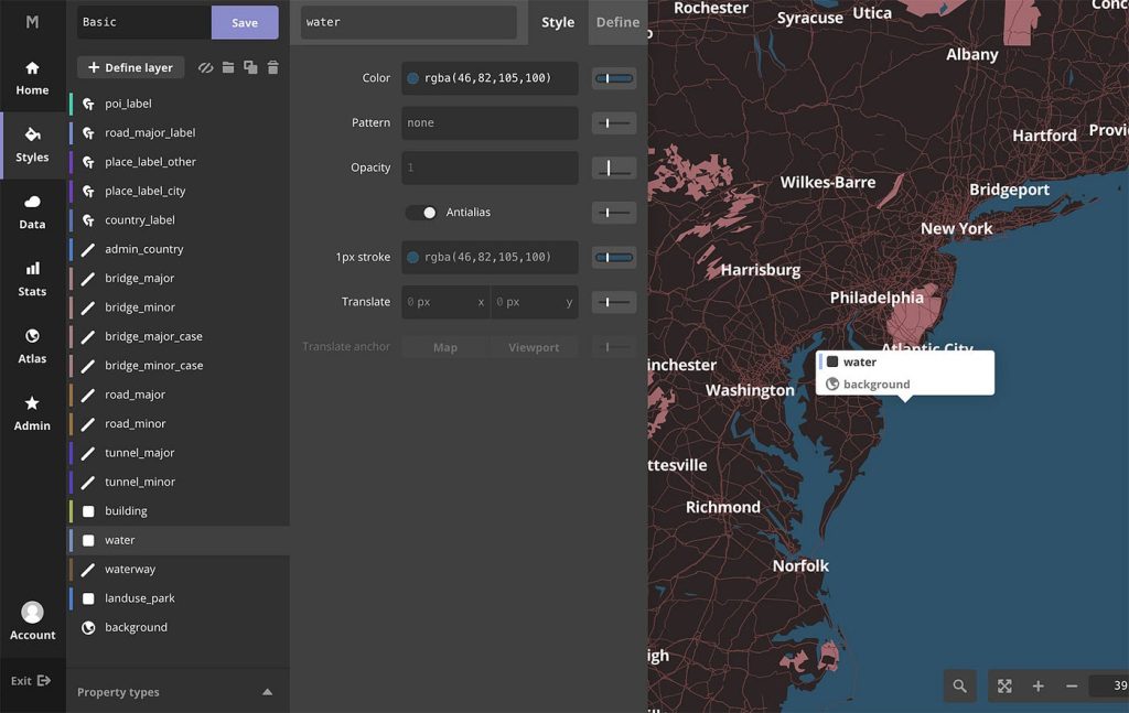
Mapbox: Making Maps Beautiful
If OSM is the Wikipedia of maps, then Mapbox is like the professional design studio that turns that raw information into something gorgeous. Founded in 2010, Mapbox has become a major player by focusing on customizable, beautiful maps for developers.
Where Mapbox Gets Its Data
Mapbox has a really smart approach to data collection:
- OpenStreetMap: Their base layer comes from OSM data
- Satellite imagery: They process and enhance imagery from commercial providers
- Telemetry data: Anonymous location data from millions of users of Mapbox-powered apps
- Government sources: They incorporate open data from government agencies
- Proprietary data: They purchase some specialized datasets
- AI and machine learning: They use computer vision to extract features from satellite images
What’s really cool is how they process this data. They have these massive systems that constantly update their maps, improving road networks, adding buildings, and fixing errors. Their AI can even detect new construction sites from satellite images!
Mapbox’s Business Model
Unlike OSM, Mapbox is definitely a for-profit company (valued at over $1 billion). They make money through:
- Usage-based pricing: Charging based on map loads or API calls
- Tiered subscriptions: From free developer accounts to enterprise plans
- Custom enterprise solutions: Big companies pay for specialized implementations
This model has worked really well – they power maps for Snap, Instacart, The Weather Channel, Strava, and tons of other apps you probably use every day. They’ve managed to compete with Google by offering better customization, more reasonable pricing, and focusing on developers’ needs.
MapLibre: The Open-Source Rebellion
OK so here’s where the story gets interesting. Mapbox used to have this awesome open-source rendering library called Mapbox GL JS that lots of developers used. But in 2020, they changed the license to make it less open. A bunch of developers and companies weren’t happy about this, so they created a fork (basically a copy that they could keep developing independently) called MapLibre.
Where MapLibre Gets Its Data
MapLibre itself is just a rendering engine – it doesn’t come with any map data. It’s designed to work with:
- OpenStreetMap via various tile services
- Custom data sources that you provide
- Commercial tile providers like Maptiler, Stadia Maps, etc.
- Any vector tile source following the right format
MapLibre’s Business Model
MapLibre doesn’t have a traditional business model – it’s an open-source project maintained by a community of developers and sponsored by companies like Meta, Microsoft, Amazon, and others who rely on open-source mapping tools. The project itself doesn’t charge anything, but many companies offer MapLibre-based services commercially.
This is actually super relevant for EarthScene – we could use MapLibre as our rendering engine without worrying about sudden license changes or high costs as we scale up!
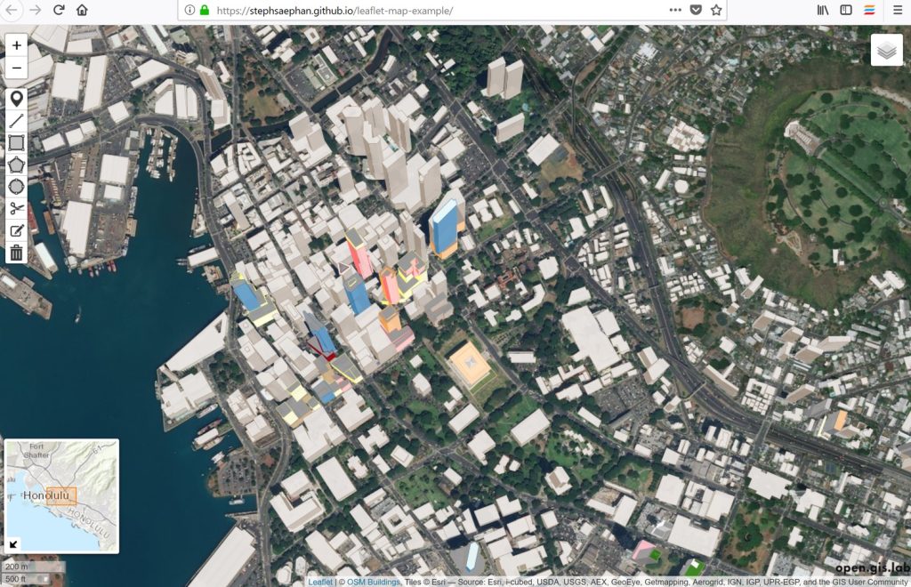
Leaflet: The Lightweight Champion
Leaflet has a special place in my heart because it was the first mapping library I ever used in a project. Created in 2011 by Vladimir Agafonkin (who later joined Mapbox), Leaflet is all about simplicity and performance.
The entire library is only 39KB! That’s like, ridiculously small. For comparison, the JavaScript for a typical website might be several megabytes.
Where Leaflet Gets Its Data
The cool thing about Leaflet is that it’s completely data-agnostic. It doesn’t come with any map data at all – it’s just a tool for displaying maps from any provider. You can use it with:
- OpenStreetMap tiles (most common free option)
- Google Maps (through plugins)
- Mapbox
- Bing Maps
- Any custom tile server you want
Leaflet’s Business Model
Like MapLibre, Leaflet is an open-source project without a direct business model. It’s maintained by a community of developers and used by organizations from The New York Times to GitHub to Flickr. The original creator now works at Mapbox, but the project remains independent.
Companies that provide commercial support or services built on top of Leaflet do make money, but the core library remains free and open-source.
Comparing the Alternatives for EarthScene
Now that I’ve researched all these platforms, I put together this table to help us decide which ones might work best for our EarthScene project:
| Platform | Pros | Cons | Best For |
|---|---|---|---|
| OpenStreetMap | Free data, community-supported, no usage limits | Data quality varies by region, need to self-host | Base data source |
| Mapbox | Beautiful design, great tools, good documentation | Can get expensive at scale, licensing changes | Professional-looking maps |
| MapLibre | Open source, no vendor lock-in, customizable | Needs more technical expertise, self-hosting | Long-term development |
| Leaflet | Super lightweight, easy to learn, flexible | Fewer built-in features, less performance with big datasets | Simple interactive maps |
My Takeaways for EarthScene
After all this research, I’m thinking our best approach for EarthScene might be:
- Use OpenStreetMap as our base data source – it’s free, we can contribute back to it, and we won’t face API limits
- Build on MapLibre for rendering – this gives us control and protects us from future licensing changes
- Start with Leaflet for our first prototype – because it’s so easy to implement and I already know how to use it
- Consider Mapbox for specific features where their specialized tools would save us a lot of development time
The coolest part? Most of these tools can work together! We aren’t locked into just one platform like we would be with Google or Apple Maps.
Another big realization: our EarthScene platform could potentially CONTRIBUTE to OpenStreetMap. Any earth data we collect that’s suitable for OSM could be fed back into the project, which helps everyone!
What’s Next?
I’m planning to build a quick prototype using Leaflet and OpenStreetMap data to test some of our core EarthScene concepts. I’ll be posting that process soon!
Have you used any of these mapping platforms before? Or do you stick with the big players like Google and Apple? Let me know in the comments!
– TM, Founder of EarthScene
Posted on March 4, 2025