Hey everyone! TM back again with more mapping platform research for our EarthScene project. Today I’m diving into Apple Maps – the default navigation app for iPhones and other Apple devices. I was especially curious about where Apple gets its map data from, since unlike Google, they didn’t start by driving around cars with cameras!
The Rocky Beginning (2012)
So Apple Maps had a pretty rough start! Before 2012, iPhones actually used Google Maps as their default navigation app. But in September 2012, Apple decided to drop Google and launch their own mapping service with iOS 6.
This first version was… kind of a disaster, not gonna lie. There were tons of issues like:
- Misplaced landmarks and businesses
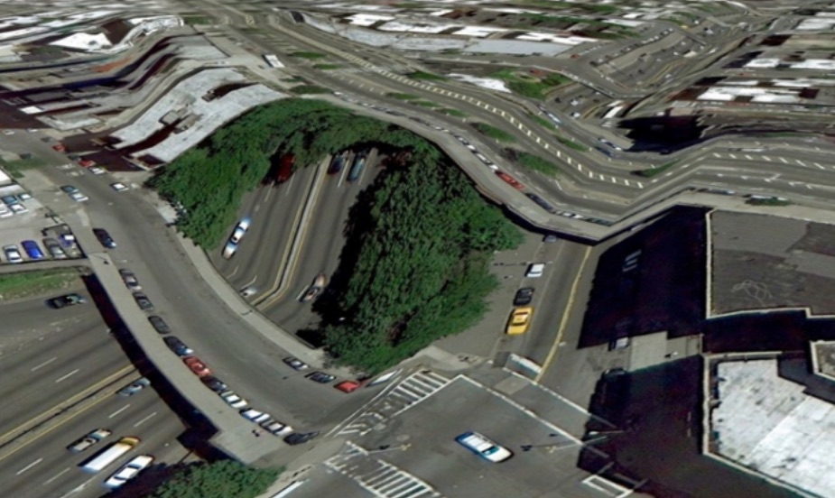
- Weird 3D rendering glitches that made bridges look like they were melting
- Awful navigation directions that sometimes led people to dangerous areas
- Missing public transit info
It was so bad that Apple’s CEO Tim Cook had to publicly apologize, and it led to a major executive shakeup at Apple. Not the greatest launch ever!
Rebuilding and Improvement (2013-2017)
After the rough launch, Apple spent the next few years trying to fix their maps and rebuild user trust:
- 2013: Acquired several mapping companies to improve their data
- 2014: Added indoor mapping capabilities
- 2015: Finally added public transit directions
- 2016: Opened up Maps to developers with MapKit JS
- 2017: Added indoor maps for malls and airports
The Big Rebuild (2018-2021)
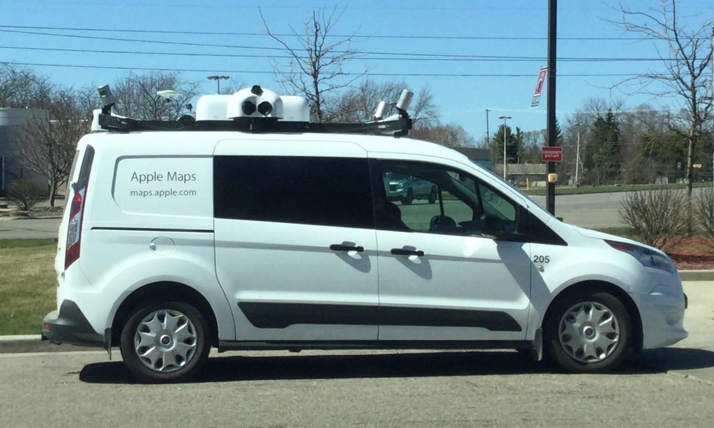
In 2018, Apple announced they were completely rebuilding Maps from the ground up. This was HUGE. They decided to stop relying so heavily on third-party data and collect their own data instead. They started using specially equipped Apple Maps vans with LiDAR sensors, cameras, and GPS (kinda like Google’s Street View cars).
The rebuild included:
- Way more detailed roads and coverage
- Better pedestrian data
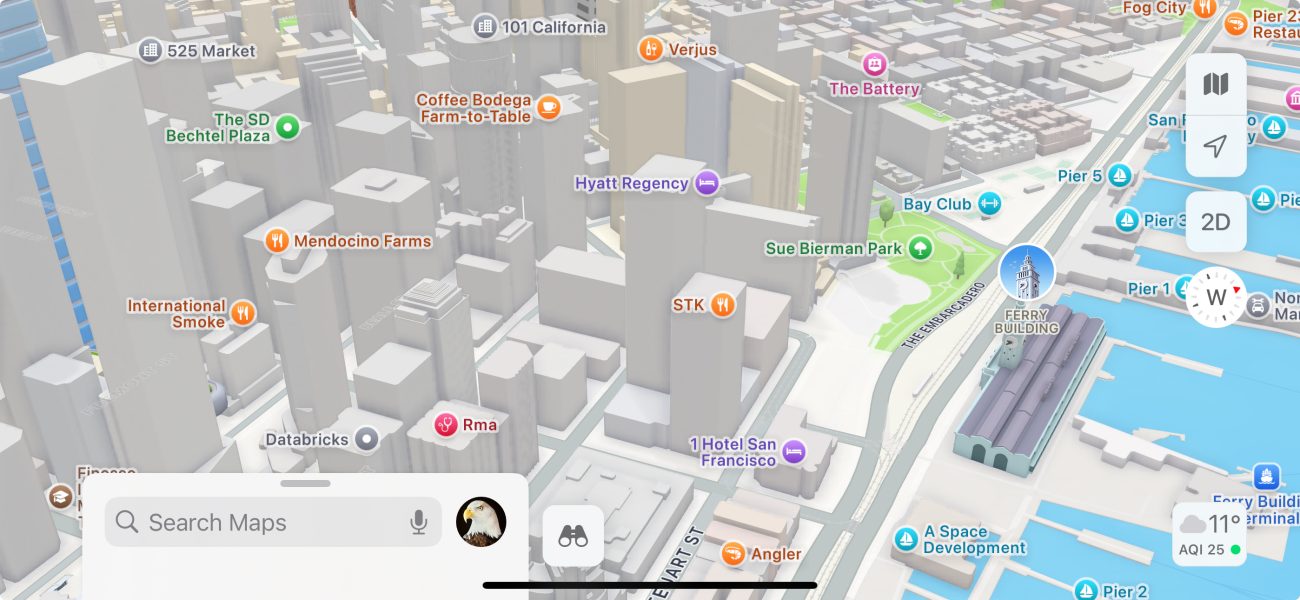
- Look Around feature (Apple’s version of Street View)
- Much more accurate place data
- Custom landmarks with detailed 3D models
https://www.reddit.com/r/mildlyinteresting/comments/8fm7fm/i_found_an_apple_maps_van_today/
Recent Features (2022-Present)
In the last few years, Apple has been adding some pretty sweet features to compete with Google:
- 2022: Detailed city experiences with 3D landmarks
- 2023: Offline maps (finally!) and EV routing for electric vehicles
- 2024: More AR features and custom routes
Where Apple Gets Its Map Data From
This is the part I was most interested in for our EarthScene project. Apple’s approach to data is really different from Google’s, as they use a mix of their own data collection and partnerships. Here’s the breakdown:
Apple’s Own Data Collection
- Apple Maps vans: Since 2015, they’ve been driving vans equipped with LiDAR, cameras, and GPS to collect street-level imagery and data
- Aerial imagery: They capture their own high-resolution aerial photos
- Anonymized user data: They collect anonymous data from iPhone users (like traffic patterns) while maintaining privacy
- Indoor mapping team: They have teams that create detailed maps of malls and airports
Major Data Partnerships
- TomTom: One of their biggest data providers for road networks and navigation
- OpenStreetMap: Uses some OSM data in regions where their own data is limited
- Yelp: For business listings and reviews (though they’re moving away from this)
- Foursquare: Additional points of interest and venue data
- Waze: Surprisingly, they use some Waze data despite it being owned by Google!
- Regional transit authorities: For public transportation data
Key Acquisitions
Apple has bought a bunch of mapping companies to improve different aspects of their maps:
- Placebase (2009): One of their first mapping acquisitions before Maps launched
- Poly9 (2010): 3D mapping technology
- C3 Technologies (2011): 3D mapping technology worth $240 million
- Locationary (2013): Local business data aggregation
- HopStop (2013): Transit navigation data and technology
- Embark (2013): Another transit app for trip planning
- BroadMap (2013): Mapping data management
- Coherent Navigation (2015): High-precision GPS technology
- Indoor.io (2015): Indoor mapping
- Mapsense (2015): Data visualization
- Hyper (2020): AI-powered mapping company
- Weather Machine (2020): For their hyperlocal weather forecasts
Apple Maps vs. Google Maps Today
After all these improvements, Apple Maps is actually pretty good now! But there are still some key differences from Google Maps:
| Feature | Apple Maps | Google Maps |
|---|---|---|
| Global coverage | Good but not as comprehensive | Almost everywhere |
| Business info | Improving but less detailed | Very comprehensive |
| Navigation accuracy | Now on par in most areas | Slightly better, especially in remote areas |
| Traffic data | Good in major cities | Excellent nearly everywhere |
| Privacy focus | High – uses on-device processing | Lower – collects more user data |
What This Means for EarthScene
Looking at Apple’s approach to mapping gives me some cool ideas for our platform:
- Maybe we don’t need to collect ALL our own data – strategic partnerships could save us time and money
- Privacy is becoming a bigger selling point – we should make this central to EarthScene
- The importance of good 3D rendering for landmarks
- How acquiring smaller, specialized companies can quickly add features
I think the biggest takeaway is that even Apple, with all their resources, couldn’t build a great mapping platform overnight. It took years of work, billions of dollars, and multiple acquisitions. For EarthScene, we need to start with a focused approach – doing one thing really well before expanding.
Next on my research list is digging into more specialized mapping platforms that might be closer to what we’re building with EarthScene!
Are you an Apple Maps or Google Maps person? What features do you think Apple Maps still needs to add? Drop your thoughts in the comments!
– TM, Founder of EarthScene
Posted on March 4, 2025